
El Niño is the planet’s naturally recurring chaos agent, scrambling weather patterns, spiking global temperatures and typically reaching full strength by December.
But this year’s El Niño, which is expected to be record-breaking, is already strong and having big effects, nudging up global temperatures and causing dry spells and crop failures on multiple continents.
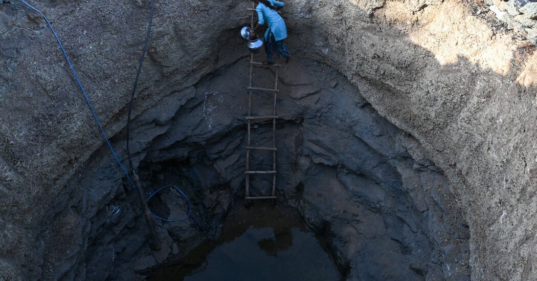
Parts of Panama, normally one of the wettest countries on Earth, haven’t had a major storm since early May. Ethiopia’s fertile highlands are enduring one of their driest summer stretches in four decades. And India had its fifth-driest June since the country’s modern rain records began in 1901.
“This is a good sign that the El Niño response has really kicked in,” said Chris Funk, director of the Climate Hazards Center at the University of California, Santa Barbara. Dr. Funk termed it an “early onset El Niño.”
These on-the-ground consequences reflect the magnitude of the changes in the Pacific Ocean, where El Niños develop when unusually warm waters build up. These episodes occur every two to seven years and have contributed to planetary swings going back millenniums. But this year’s is on track to be the strongest in nearly 80 years of records.
Scientists are debating whether human-caused climate change is tilting the odds toward stronger and more frequent El Niño events. The El Niños of the past few decades have been comparably strong. But the variables that combine to create an El Niño are complex, and some experts argue the recent trend could just be a random signal.
What’s clear is that El Niño’s gyrations are adding to the stronger storms, drier dry spells and fiercer wildfires that global warming is already bringing about. El Niño will magnify those phenomena in some regions and could lift global temperatures to record levels next year, as the heat from the Pacific spreads around the world.
“What we’ll see in 2027 is a sneak peak of what the new normal will be in 2035,” said Zeke Hausfather, a climate scientist at Berkeley Earth, a nonprofit research organization. “We’ll see things that have never happened before in our history in terms of temperature, drought conditions, extreme heat.”
A year of extreme heat
El Niño events are measured by looking at sea surface temperatures in a specific rectangular zone of the Pacific Ocean. Temperatures there have soared over the past three months, and forecasts suggest that, by year’s end, they could exceed normal levels by more than they did during the strongest El Niños in modern history, which occurred in 1982-83, 1997-98 and 2015-16.
Between October and December, the National Oceanic and Atmospheric Administration says there’s an 81 percent chance that El Niño conditions will be “very strong,” meaning the three-month average temperature in that zone of the Pacific is 2 degrees Celsius, or 3.6 degrees Fahrenheit, higher than normal. But forecasts show that daily ocean temperatures during that period could spike to more than 3 degrees Celsius above normal.
“Maybe it doesn’t sound that big: three or even four degrees. We see that temperature variation over the course of a day,” said Samantha Stevenson-Karl, an associate professor and climate modeler at the University of California, Santa Barbara. “But the ocean doesn’t change that much. Like, ever.”
The extra heat in the waters of the Pacific affects air temperatures, too. For the first months of the year, 2026 was clearly cooler than 2024, the planet’s hottest year on record. But Dr. Hausfather still gives 2026 a 40 percent chance of being Earth’s warmest year on the books, a sign of how the pendulum could be swinging. According to NOAA, last month tied July 2024 as the world’s warmest July since global record-keeping began in 1850.
A rise in acute hunger
El Niño causes big shifts in the winds that blow moist air across the oceans, and the effects on rain-fed agriculture are already emerging in some regions. By the end of the year, El Niño could cause nearly 50 million more people across the globe to experience acute hunger, an increase of roughly a fifth, according to the United Nations World Food Program.
At the western end of the tropical Pacific, El Niño has led to a dry summer in parts of Southeast Asia, delaying the sowing of rice and other crops in Thailand, Cambodia, Vietnam and the Philippines. In India, monsoon rains have picked up in some regions in recent weeks, though large areas of the country remain in a rainfall deficit.
At the other end of the Pacific, El Niño has delayed planting and disrupted crop growth in Central America. Rainfall in Guatemala was as much as 85 percent below average in July, and the stress on crops has been compounded by well-above-normal temperatures.
In Panama, the dry stretch has raised concerns about operations in the Panama Canal. During the last El Niño, in 2023-24, a severe rain deficit snarled traffic in the waterway, which raises and lowers ships through the locks using water from a rain-fed lake.
As El Niño has gained strength, the Panama Canal Authority has tightened limits on how heavily loaded ships can be while crossing. Officials haven’t ruled out restricting daily transits, according to a statement last week from a spokesman for the canal authority, Octavio Colindres.
It’s hard to predict just how much below normal Central America’s rainfall will be in the coming months, said Steven Paton, who monitors the oceans and atmosphere at the Smithsonian Tropical Research Institute in Panama.
The reason, he said, is that scientists’ computer models are trained on past events. This year’s El Niño is expected to be so much stronger than any episode on record that we can’t be sure how accurately the models will anticipate its effects.
“At the very least, it’s going to be as bad as the worst we’ve seen before, possibly much worse,” Mr. Paton said.
In East Africa, El Niño usually brings heavy rain, and even floods and landslides, from November through January. But when the phenomenon appears earlier in the year, it can suppress rainfall in parts of the region, including western Kenya and Ethiopia.
That’s been the dire reality in recent months, said Chris Shitote, a field scientist based in Nairobi, Kenya, for the Famine Early Warning Systems Network, an agency under the U.S. State Department.
Mr. Shitote and some colleagues recently traveled through Kenya’s western grain-producing counties. The maize harvest was stunningly bad, he said. “It’s something some of us have not seen for the maybe 10 years we’ve been going out.”
Plants that normally grow to be nine feet tall topped out at just five or six feet, Mr. Shitote said. A typical harvest might yield 20 to 30 bags of corn for each acre of field, growers told him. This year, it looks like it could be just one or two bags per acre.

